|

                   
The southern Caribbean's
beaches & deserts...
|
|
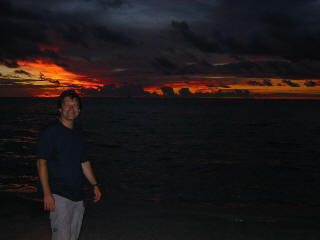
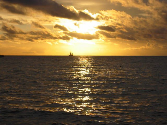
Aruban sunset |
I took another opportunity
to do a short autumn "sanity vacation", this time to
Aruba. Aruba is located in the southern Caribbean, 20 miles off the coast of Venezuela. South American
mountains are clearly visible from the airport and all
along the southern coast. Aruba is outside of the normal
hurricane track, this year escaping the destructive
storms to the north with just some heavy rain. It's one
of the Dutch 'ABC islands' along with Bonaire and
Curacao. It is roughly 20 miles long and 6 miles across.
The weather in late October was perfect, with no rain
and 80° F days and nights, cooled by mild tradewinds. I
returned to Aruba in April
2009 and in July 2013. |
|
|
Aruba feels very safe -
safer than most of the US, with friendly people who are used
to tourists. English is universally spoken. Although Aruba has
its own currency - florins, US dollars are accepted everywhere.
Gambling is legal and casinos abound. Bugs weren't any problem
except at dusk, right around the water. Driving is on the
right, signs are in English and the roads are generally in
good shape, but often poorly marked. Hotels are segregated
into downtown (Oranjestad), low-rise (Eagle Beach) and high-rise
(Palm Beach) as you
proceed north from the airport. |
The Natural Bridge - on the north
coast |
|
Friday October 22nd
Landing at Aruba's Queen Beatrix
airport was a bit of an adventure. We did a first pass at the
runway and then suddenly pulled up. Then we did the same thing
again. The passengers got concerned in a hurry, myself
included. Fearing landing gear troubles or some other disaster
in the making, we were finally informed by the captain that a
goat was spotted near the runway and had to be corralled away.
Finally landing just after noon AST, I passed through
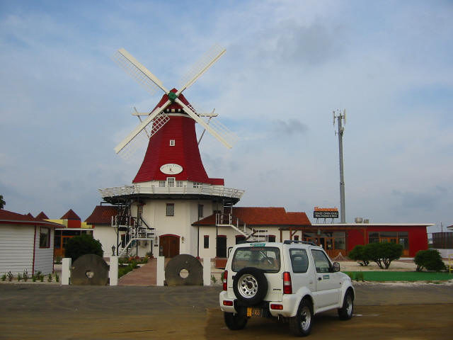
immigration quickly and easily. I rented a Suzuki Swift 4
wheel drive mini-SUV (parked in front of the windmill in the
first picture above) to allow off-road exploration of Aruba's
rugged north shore. After one wrong turn at an unmarked traffic circle
which I quickly corrected, I got up to my hotel, the
Aruba Marriott, around 1pm. The hotel was a disappointment
in many ways, although it wasn't terrible. They didn't have
any rooms ready and made clear they wouldn't try to get any
ready before 3pm, although I had requested an early check-in a
month before. I had also paid ahead for an upgrade to a
"deluxe ocean view" room, but when I did get into my room, the
view was anything but deluxe. A second shot after complaining
at the front desk was little better. My advice with this hotel would
be to reserve any run-of-the-house room, because they all have
at least partial ocean views.
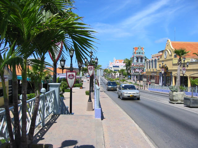
Finally situated just after 3pm,
changed into tropical clothes and ready to go, I drove south
along the coast through the high-rise and low-rise hotel
areas. It got me oriented to the island. This area has
a lot of shops, restaurants and beaches (first picture above -
a real Dutch imported windmill turned restaurant, at the
border between the low and high-rise hotel areas). I bought
supplies (Chilean wine, sippin rum, snacks) at the large
American-like Ling & Sons supermarket on the outskirts of
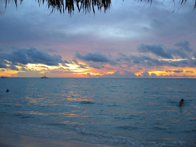
Oranjestad and headed back to my hotel for a beach walk at
sunset (second picture above). I had spotted a Spanish-style
Tapas bar in the high-rise area called Salt & Pepper, which I
walked back to for a light dinner.
Saturday October 23rd - The North
Coast Drive
I headed north in the late
morning on the coast road from my hotel to begin my off-road
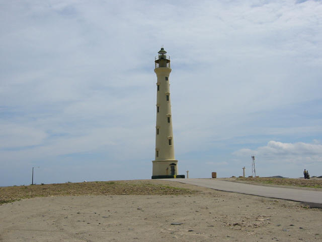
day tracing the northern coast of Aruba. The roads are paved
to the northwest tip of the island at the California Lighthouse (third
picture above), named for the ship California that went down nearby
prior to the lighthouse's completion. Contrary to some tour books and web
sites, it's not the ship Californian, infamous for ignoring
the Titanic's SOS. That ship was torpedoed off the coast of
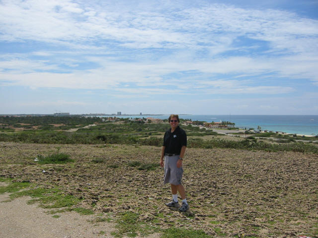
Greece in the first world war. You
can look backward from the lighthouse and see most of the
southern coast (fourth picture above - the cranes in the far
background are at the Marriott, building a second time-share
resort). At this spot there are
lots of cacti and sand dunes giving a first sense of how much
of this island is like a desert. Turning right at the base of
the lighthouse driveway, the paved road disappears and a
rocky, at times almost non-existent, dirt path begins
following the coast southward.
|
|
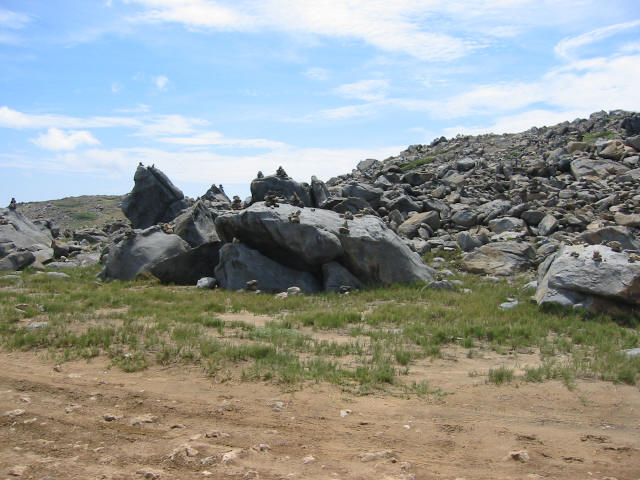
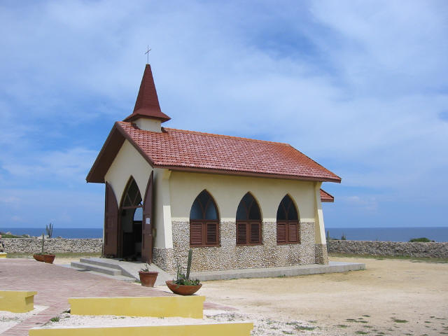
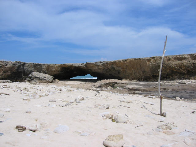
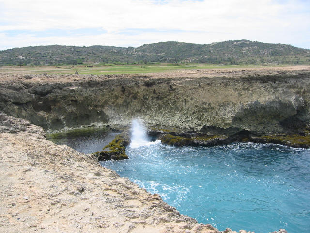
Along the
first bumpy miles, there are several "wish rock gardens" where
passers-by make a wish and build a small temple of rocks (first
picture above). A half hour further south, the Chapel of Alto
Vista (second picture above) appears up on a ridge, looking
very civilized compared to the barren coast. Soon the
road turns into mostly sand dunes and rocks, passing the
mini-natural bridge (third picture above) and a couple of blow
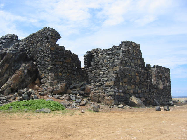
holes (fourth picture above). Nearing the abandoned
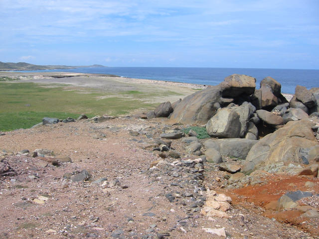
1870's Bushiribana gold smelter ruins (first picture below)
the road got steeper and more rugged, often just one car-width
wide (second picture below - road in the foreground, coastal
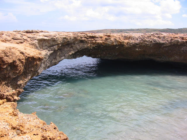
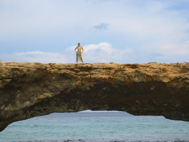
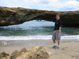
plains to the north in the background). About halfway down the northern
side of the island is the much photographed Natural Bridge
(third picture below and large picture at the top right of
this page). It's hard to grasp its massive size from pictures,
spanning roughly 100 feet at about 25 feet above the ocean,
but the fourth picture below offers some perspective relative
to the size of the person standing on it. A note looking back
from my return trip to Aruba in
2009 - the natural bridge fell into the ocean on September
2, 2005. |
|
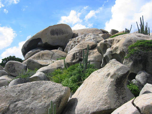
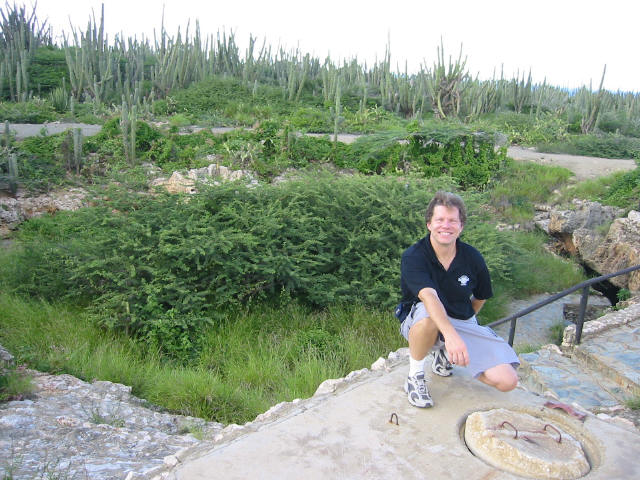
Even with
the aid of a GPS, turning inland I got lost trying to find the
Ayo Rock Formations (first picture below), which served as
Flintstones-like housing for Aruba's early residents.
Petroglyphs and natural caves were around every corner as I
climbed the path. The roads in this area were paved, but
essentially unmarked as well as nonexistent in the GPS maps,
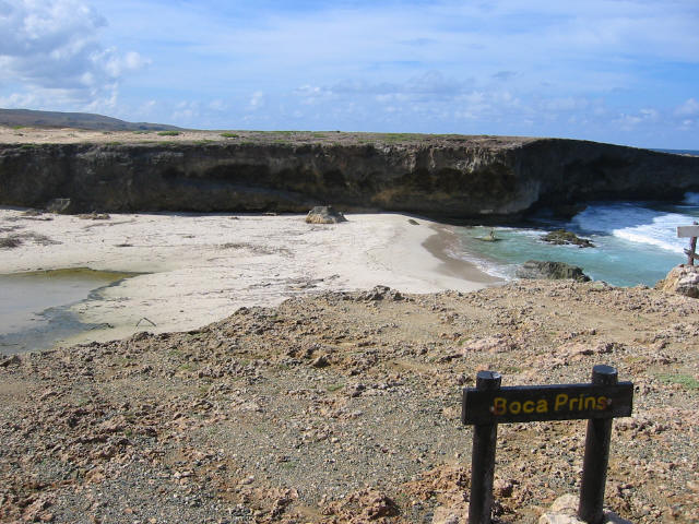
so asking for directions was the only hope. Turning south
again after Ayo, I headed into Arikok National Park. The rough
park road is bordered with minor sites like abandoned gold
mines, experimental gardens and old adobe houses as it winds
its way toward the coast. The coastal inlet, Boca Prins and
Fuente cove (second picture below) are home to sand dunes,
bleached limestone cliffs and a variety of wildlife. Sea
turtles hatch in the tide pools and run for the ocean in the
spring. It's also home to a handy bar and grill - a welcome
touch of civilization popping up in the middle of nowhere.
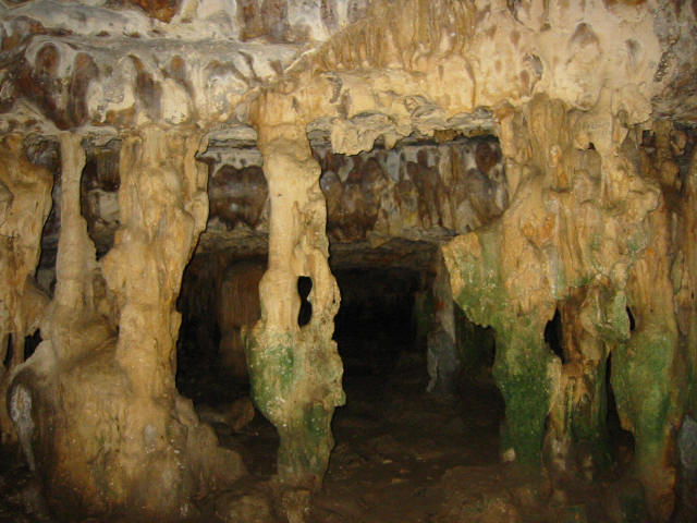
Proceeding south along the coast, there are a series of musty
bat-filled caves; Fontein (third picture below from the inside - yech!),
Quadirikiri and Baranca Sunu (also known as the tunnel of love
because of the heart-shaped entrance seen behind me in the
fourth picture below). Heading south out of the park, the road
becomes paved and ends up in Aruba's second largest city, San
Nicolas, home of a big oil refinery that dominates the
landscape. Turning north, I headed back to my hotel along the
south coast road through Savaneta with views of South America
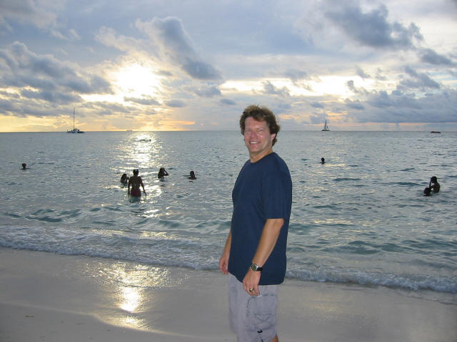
to my left. I got back just after sunset, did some writing and
then relaxed on the beach listening to music. I finished the
day with a swim in the waterfall area of a then-deserted hotel
pool. |

Mackey Group, Inc.
© 2002 - 2013
|
|