|

                 
A day's hike through
geological millenniums...
|
|

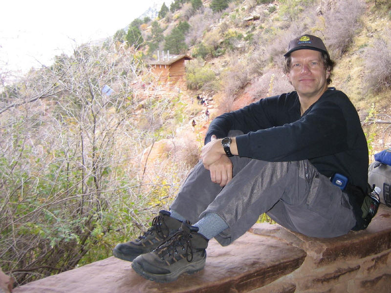
End of the hike, top of
Bright Angel trail |
I had an opportunity in
conjunction with another trip to take a day's hike in
the Grand Canyon. This was my first experience hiking
the Canyon, so I wasn't certain of my limits. The only
thing for sure was that before the end of the day I
would have to climb back up the canyon just as far as I
went down. So, armed with lots of water, Powerbars,
hiking boots and my GPS I headed out for what became a
wonderful trek of over 6 miles. The weather was nearly
ideal - sunny, cool 45°F at the rim (6800') and low-60s with a
gentle breeze down below (4000'). |
|
|
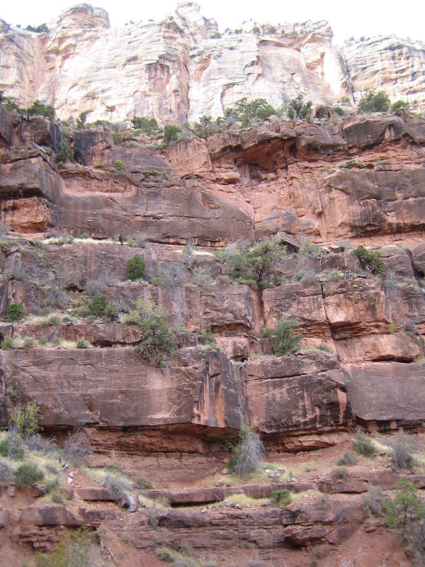
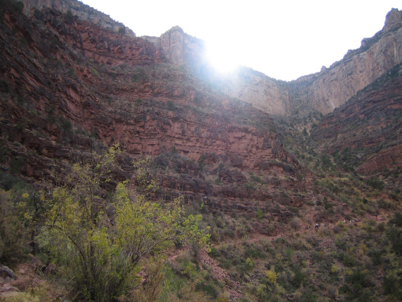
I hiked the
well-trodden Bright Angel trail, setting out from the top of
the south rim at about 10AM. The trail follows the Bright
Angel fault line, switching back and forth along the southern
canyon wall. I passed through formations of kaibab limestone
(270 million years old), toroweap limestone (273 million yo),
coconino sandstone (275 million yo), hermit shale (280 million
yo) and supai sandstone (315-285 million yo). Visible just
below that was redwall limestone (340 million yo), made red by
iron seeping down from the supai layer. |
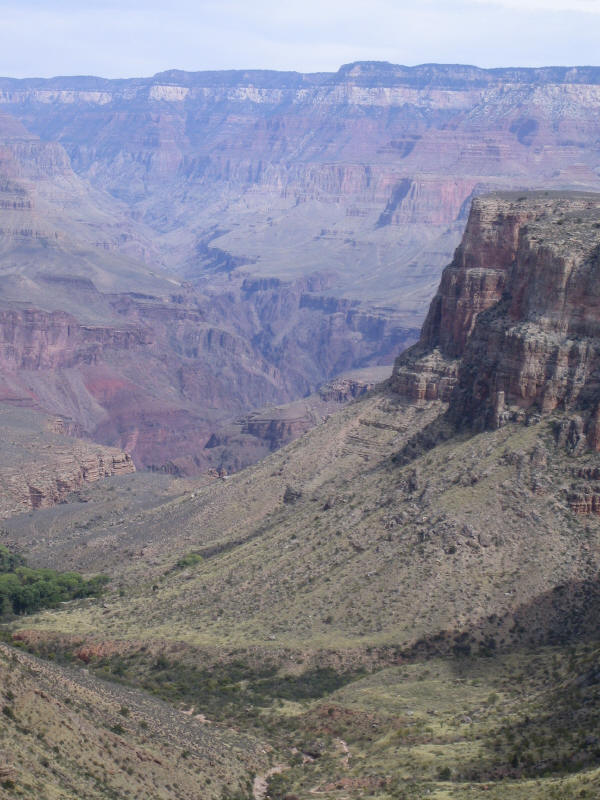
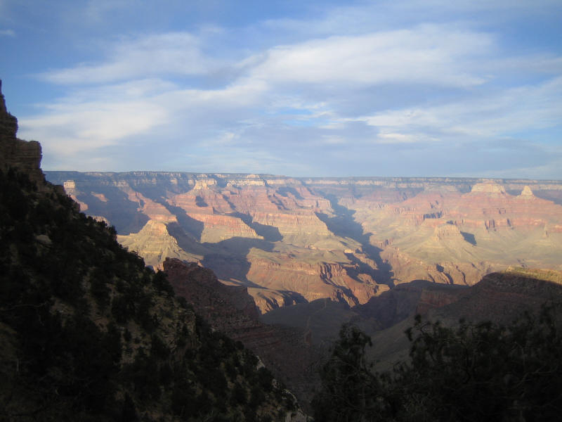
Afternoon sun lights up the North
Rim |
|
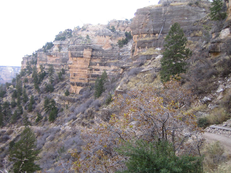
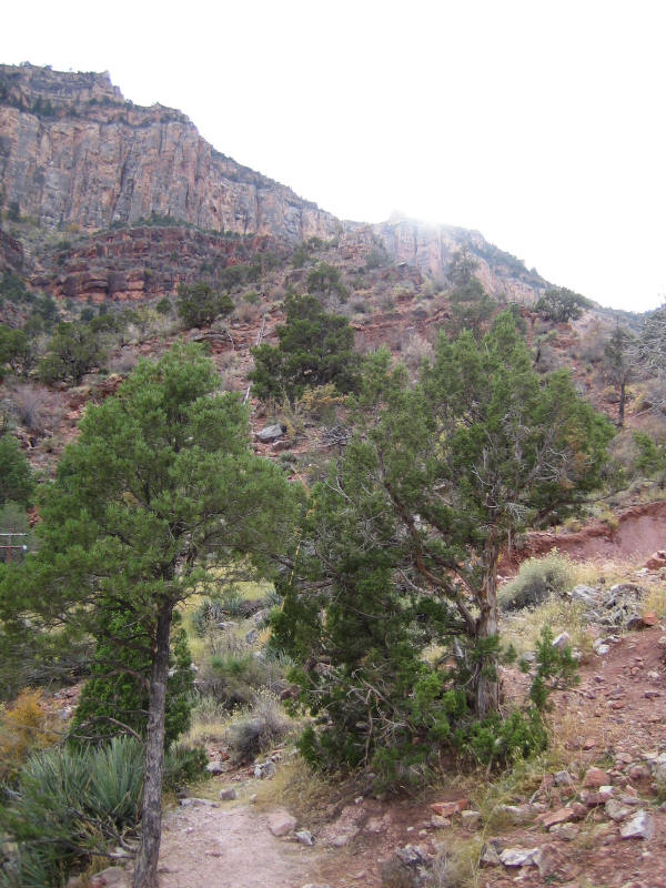
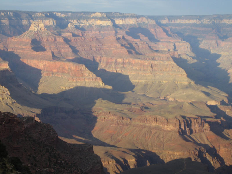
The view was
stunning in every way from the very beginning. Each layer was
clearly defined as I started my descent. The shift along the
fault line further defined the contrasts. The top layers of
limestone had plenty of vegetation growing on them (first
three pictures above). The first picture above also shows the
the black
Kolb Studio building at the top left which is right at the
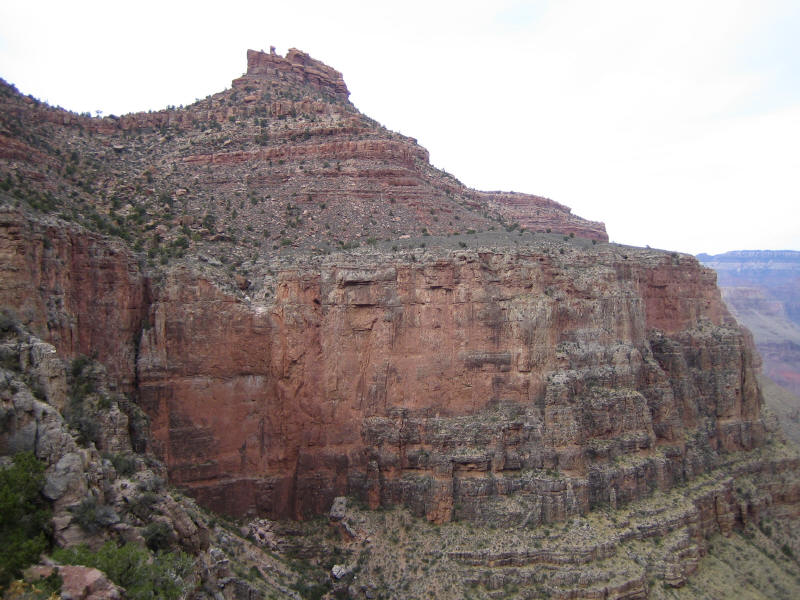
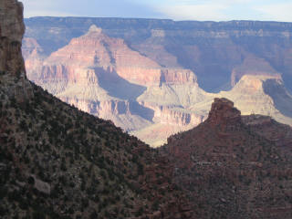
Bright Angel trailhead. The second picture above has the
"battleship" formation at its center, which also appears in
several pictures below from different levels of the hike.
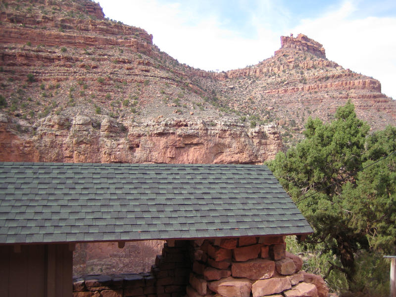
Continuing down, there's a rest stop with bathrooms at the 1.5
mile spot where I added a second pair of hiking socks and took
a short water and Powerbar break (fourth picture above). |
|
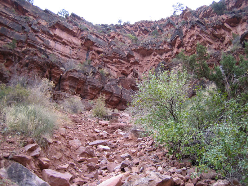
I was
certain at that point that I still had plenty of energy and
water to
continue farther down and my boots, pack and clothes were
all working well. The scenery seemed to shift with every
turn as I continued my descent (first two pictures above),
eventually finding a pace that made the hike seem completely
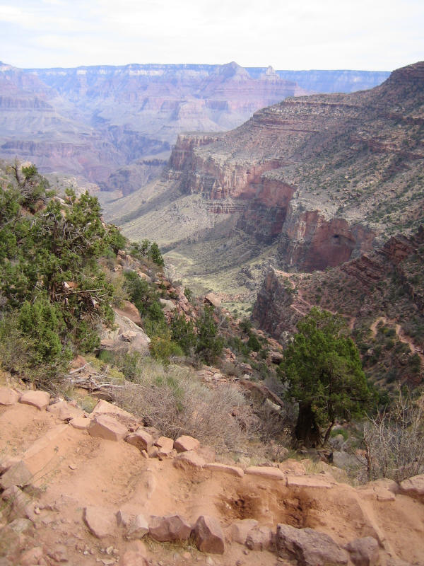
effortless. Time flew by over the next miles. Just past the 3 mile point, I stopped at a little
clearing off the path with a remarkable 360° view. The remains
of an old cable car system that was used to bring supplies
down to Indian Garden (3800') spanned the hillside. I dubbed
this my 'supai siesta spot'. For GPS adventurers, the exact
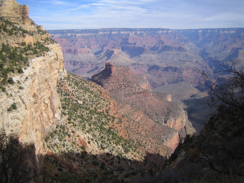
coordinates of this location are N 36°03.963', W112°08.100'. Looking down and across, I could see the valley,
the Tonto Plateau and the north
rim off in the distance (third picture above). Looking back, the
four geological layers I had hiked through were clearly
defined (fourth picture above, also showing some of the cable
car system remains). To my right was a nice ridge view framed
in trees and shadows (fifth picture above). To my left was the
"battleship" formation viewed from below its center (first
picture below). |
|
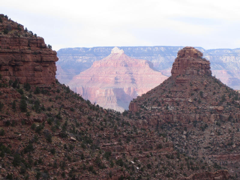
I stayed in
this spot for some time eating lunch, enjoying the view and
listening to a beautiful flute player echoing somewhere off in
the distance. At that point I had to make a decision either to
go on to Indian Garden at the 4.7 mile point where fresh water
was available or to turn back. The mid-afternoon sun was
starting to hide itself behind the ridges and I wasn't sure
how much harder the climb up would be than the hike down, so I
decided to turn around and head back up.
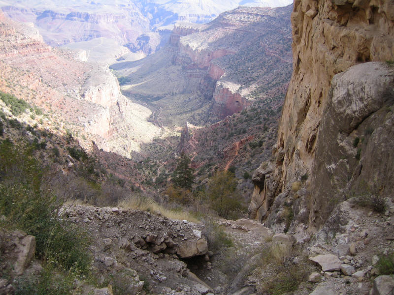
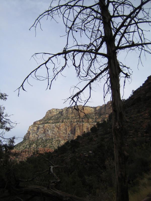
Ascending
past the 3 mile rest stop (second picture above with the
"battleship" toward the right) I was
rewarded with my first picture of the afternoon sun casting
its glow over the canyon (third picture above, which also
shows a mule caravan ascending the pathway ahead). Even though
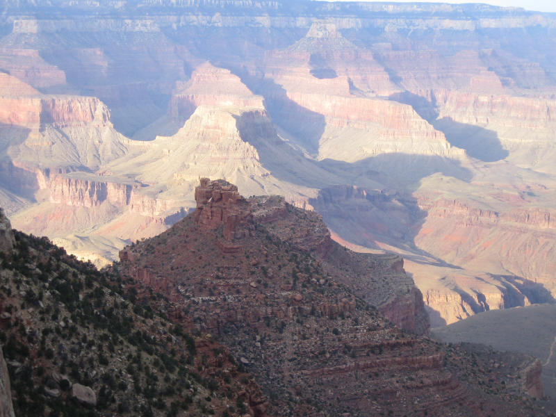
the path was the same, it seemed the view of the layers was
more profound in some spots heading up (fourth picture
above). Ascending through the 2 and 1 mile spots on the trail,
the setting sun cast a brilliant light and shadows on the
north rim (first and second pictures below and large picture
top of page right, all viewed over the "battleship"
formation). The last mile up to the trailhead offered darker
foregrounds with even more north rim colors, as a haze
began to develop in the distance (third and fourth pictures
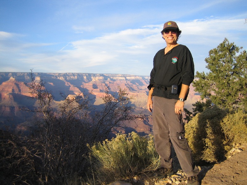
below). I arrived around 4:30PM back at the Bright Angel
trailhead - somewhat tired, yet
exhilarated from a most remarkable day (large picture top of
page left). |

Mackey Group, Inc.
© 2002 - 2010
|
|